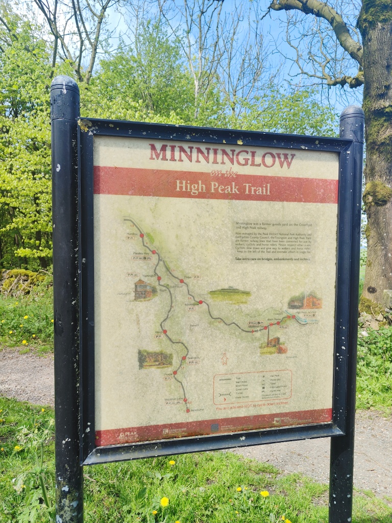
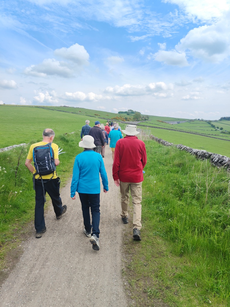
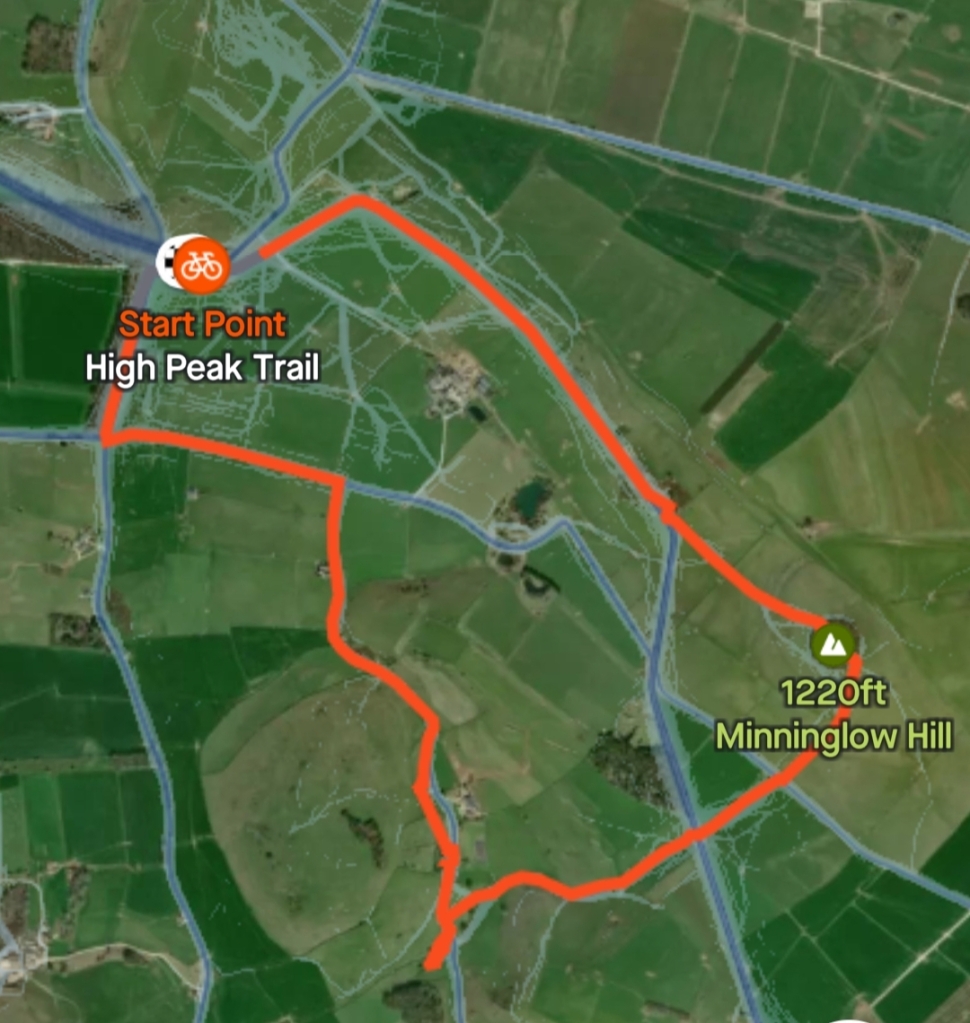
On Sunday 14th May the Society led a guided walk around Minninglow and Royston Grange, taking in and pointing out sites of historical interest along the way. There was a great turn out from the village and surrounding area and the weather was a perfect backdrop for a lovely afternoon.
The walk started from the Minninglow Car Park on the High Peak Trail which was once the Cromford & High Peak Railway, a standard-gauge line to link the Cromford Canal at High Peak Junction and the Peak Forest Canal at Whaley Bridge over a distance of 33 miles.
The railway was commissioned by Act of Parliament in 1825 and completed in 1831, and built to carry minerals and goods through the hilly rural terrain of the Peak District. At the time canals were still the preferred means of goods transport but the gradients and lack of water on the plateau made this impossible.
With its bridges and bends, the railway looks like a canal and indeed the initial planning in the 1820s was to make it a canal, however this idea was dismissed as impractical, and the railway won out.
The railway’s surveyor was Josias Jessop, son of William Jessop, an esteemed canal engineer in his time. Jessop made the track follow the natural contours wherever possible like a canal.
Jessop estimated the cost of building the railway to be £155,000 to £164,000, and even when the final cost was found to be £180,000, this still worked out much cheaper than a canal. It remained foremost as a freight route, serving the limestone quarries and dairy farms in the area, but sadly the line was never to achieve a profit.
Because the original trains were pulled by horses, the tracks were laid on stone blocks with no sleepers to provide a smooth track for the horses. The route was marked by several steep inclines at Cromford, to Sheep Pasture, Middleton and Hopton, with winding engines hauling the trains up onto the limestone plateau, of a similar nature to a flight of canal locks. The nature of the line as it followed a twisting canal-like route with the steepest bend reaching 80 degrees near Gotham, resulted in slowing the trains down, and only short wheelbase wagons and small locomotives could be used on the line because of the tightness of Gotham Curve.
Whilst steam engines were invented some time earlier, it was only in 1825, when Stephenson built Locomotion No. 1 for the Stockton and Darlington Railway, that the first public steam railway in the world was introduced. And for this line, the first steam engine was not seen until even later in 1841. By 1860 the line had six more locomotives gradually displacing the horses, but passenger services were only ever one train a day from 1856, with the nearest stations being at Longcliffe and Friden. It’s reported that sadly a passenger was killed in 1877 and this led to the passenger
service being discontinued.
Built as part of the London and North Western Railway, the Buxton to Ashbourne railway line opened in 1899, with a section of line south from Parsley Hay. In 1963 the inclines from Middleton to Cromford were closed, bringing this archaic section of the route to an end, and a truncating of the line from Parsley Hay south towards Middleton followed in 1967, bringing to an end nearly 140 years of locomotive traffic along the route.
The Peak District later bought the track in 1971 and created the current High Peak Trail.
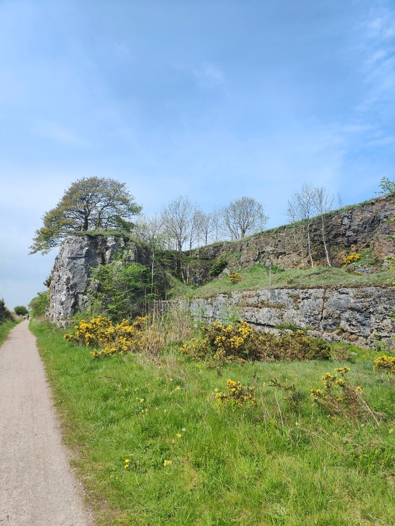
The walk carried on through the embankment, which is approximately a sixth of a mile in length and 50ft high. Stone used to build the embankment was from local quarries and cuttings from along the route.
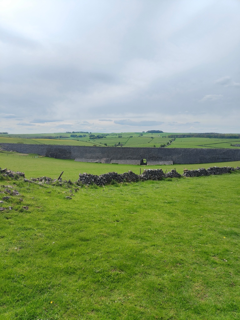
The geology of the Minninglow area is interesting, with a bedrock of Bee Low Limestone and Monsal Dale Limestone, and dolomites towards Royston Grange. Evidence of historical lava flows such as Lower Matlock Lava to the east of Minninglow can be seen in Aldwark and Minninglow grange is itself a glacial head.
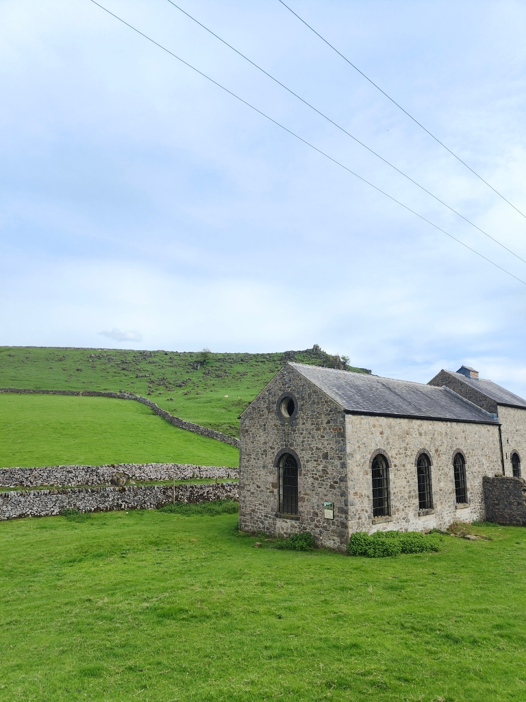
The local lime kilns dating back to the early 19th century, recently collapsed and have been restored. These kilns were used to produce Quicklime, by heating crushed limestone to around 1,100 degrees Celsius in a shaft furnace. Quicklime was widely used in the area for:
- steel works
- agriculture (spread on fields to increase fertility especially on acid soils)
- chemical industries
- construction (plaster, cement, whitewash, cement)
Lime kilns are likely to have been introduced to England by the Romans who were heavy users of the cement they generated.
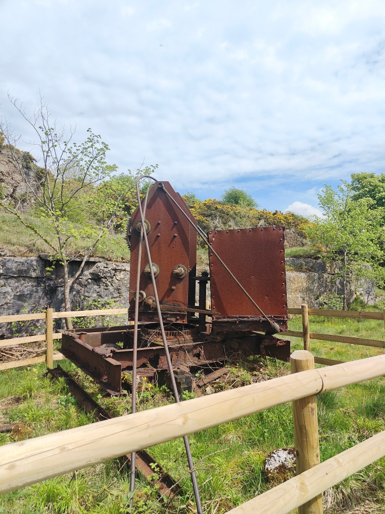
The Brickworks located at the junction of the railway and the old trackway were built sometime between 1850 and 1890, but went out of use by 1910. They used the natural geological feature of sand pockets in the limestone, mined from the now flooded quarry pit. The site made high quality, high temperature bricks which sadly proved uneconomically for such a small-scale production.
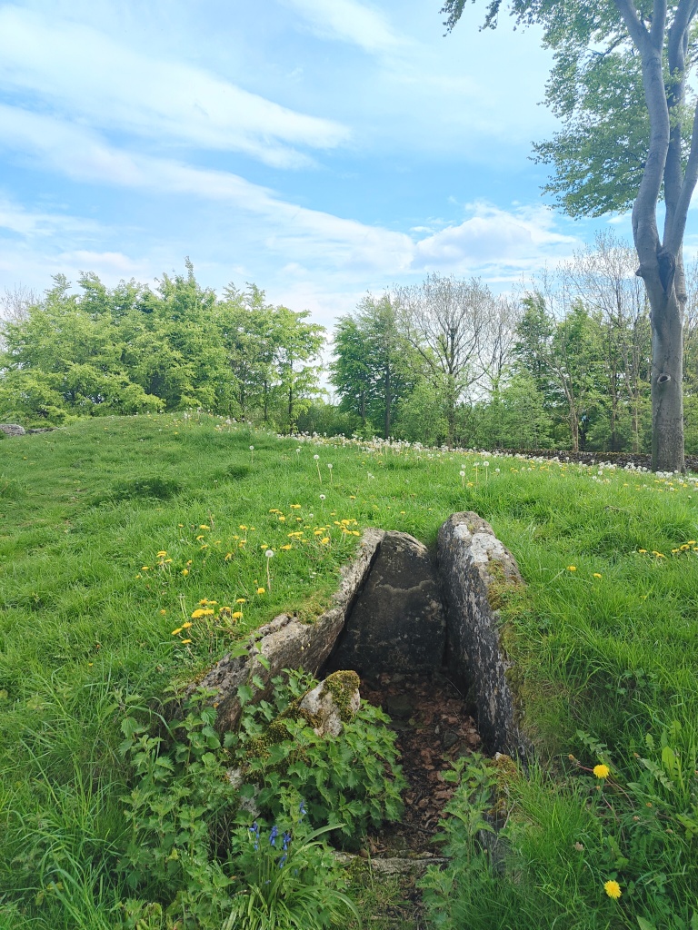
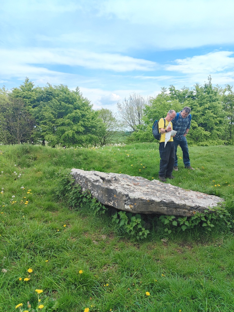
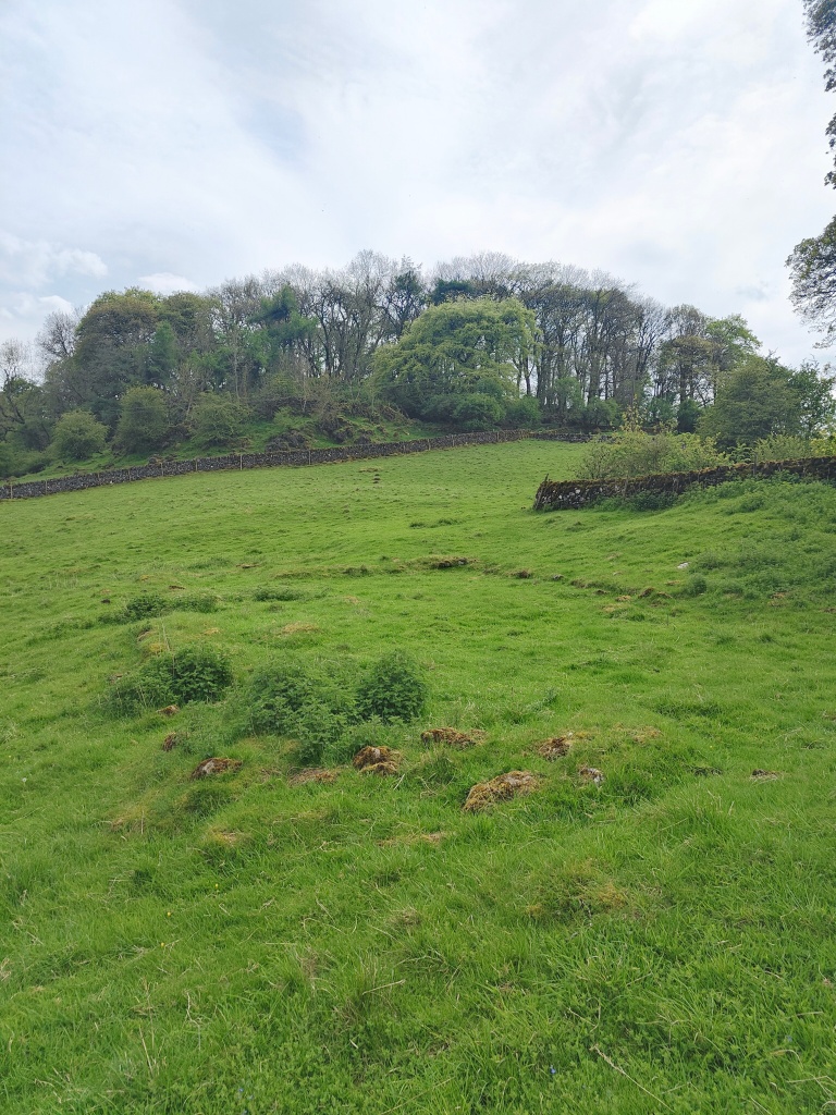
The walk continued on to the site of the Neolithic chambered tomb and two Bronze Age bowl barrows at Minninglow. Here there are two complete chambered tombs made of limestone slabs, along with at least three additional exposed, incomplete chambers with no cap stones. The chambered tomb is the largest in Derbyshire and is of an unusual type common to the Peak District in which the burial chambers are covered by a sub-circular or oval barrow (45m x 38m), instead of the more typical linear form.
The oldest chamber in this collection dates from the Early Neolithic period (4000-2500 BC), however other finds indicate use in the Late Neolithic or early Bronze Age, and into the Roman period.
It is believed the tomb served purpose for communal burials and ritual sites for local people.
The ancient chambers have been partly filled with gravel to prevent them collapsing.
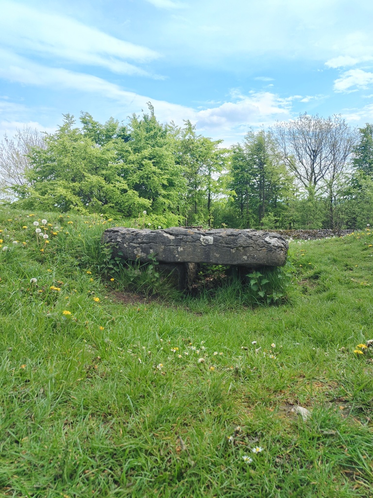
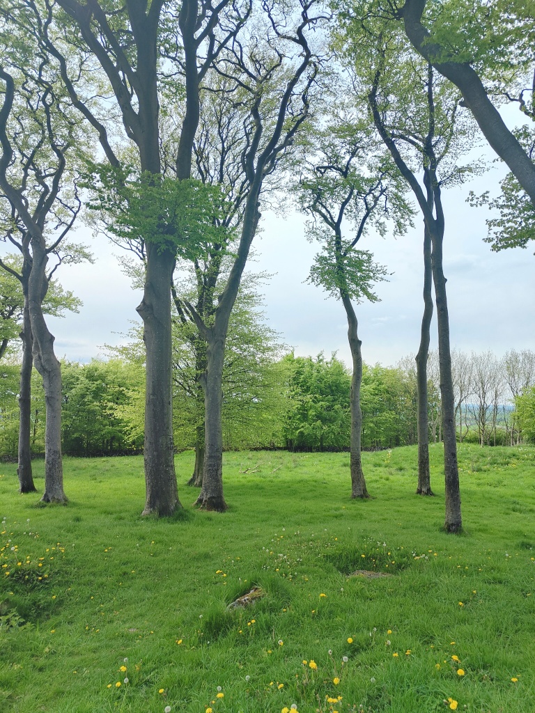
With a now distinctively modern profile, the beech trees are believed to have been planted around the Victorian era, and the site being encircled later by a stone wall and smaller trees for protection. In Neolithic times it is likely the site would have stood above the treeline and its exposed stone would have appeared white against the horizon. Today the site remains visible for miles, including from Arbor Low which is thought to be of a similar time period.
During the partial excavations of the site by Thomas Bateman in 1843 and 1851, the mound was found to be constructed of coursed stone and the chambers to contain human bones, including one extended skeleton, fragments of Romano-British Derbyshire ware pottery dating from the 3rd Century, as well as several Roman coins and bronzes, the latter evidencing that the barrow had been disturbed in the third or fourth century AD. Beaker sherds found by Bateman indicate a Late Neolithic or Bronze Age date for the particular chamber where the finds were made, and represents the latest phase of Prehistoric use since further excavation, leading to the barrow being interpreted as a multi-period site.
Continuing on from the Minninglow site, a no longer visible Roman road known in Saxon times as Cyngstraet (King street), ran the route between Buxton and beyond to Carsington, and on to Derby. Carsington was believed to be Lutadorum, an important centre of the lead mining industry for the Romans. The road is believed to pre-date Romans to at least Bronze age, and passes very close to Arbor Low so is likely to have linked these two sites in neolithic times, and has a long line of stone walls passing a little to the east of Minninglow, across the open country beyond Pikehall with a long line of field and parish boundaries following the route continuously for 13 miles.
Following the former track to Roystone Grange, likely to be the route to the Roman road from the settlement, this was certainly a track in medieval times with foundations of a medieval wall across the field and the boundary of the Grange and trackway which joins the earlier track.
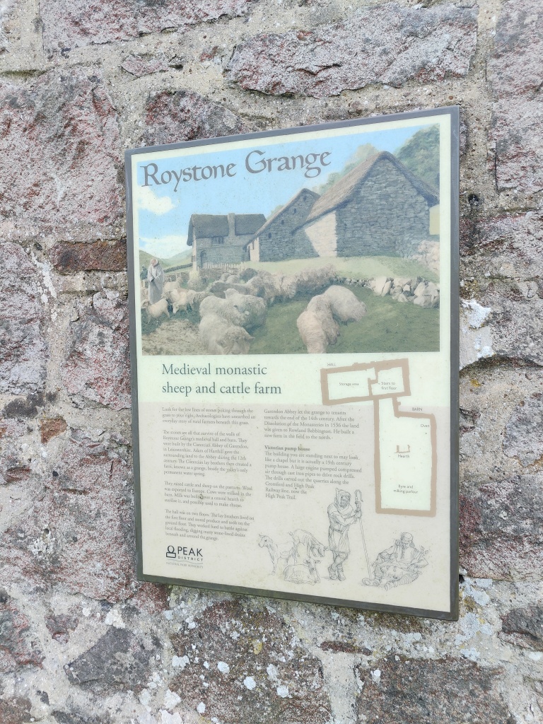
The walk took in the wider landscape close to the grange and progressed to the site of the Medieval Grange. Roystone Grange (in early records referred to as ‘Reevestones’), was owned by the Cistercian Garendon Abbey in Leicestershire, founded in 1133. Granges were used to generate cash crops for their owners and historical documents indicate that this Grange was primarily a wool producer.
The medieval monastic grange 200m south of Roystone Grange is important as although little is now visible above the ground and turf, its remains are in a good state of preservation, having suffered minimal disruption through later development. It has an intact field system associated with the domestic arrangements of the settlement, including the foundations of contemporary enclosure walls and a dewpond, identified as dating to the Romano-British period.
The grange comprises two adjacent sites with evidence that each represents a different period of occupation. The remains of buildings, platforms and enclosures in the south western part of the site are identified as those of the earliest phase of settlement during the medieval period. Excavations during the 1980s revealed that the first phase of occupation occurred during the late 12th or 13th century.
The main building appears to have been an aisled structure about 15m x 10m, with dry stone walls, the remains of which stand slightly above foundation level.
Another building to the immediate north is likely to be contemporary with the main building. A further, slightly smaller building was added during the 13th century immediately to the south and the remains of a stairway indicates it had an upper room.
This building appears to have been abandoned after a relatively short time and evidence shows that all of the buildings were deserted around the end of the 13th century. It is likely that the 12th and 13th century buildings were vacated due to frequent flooding and from about 1300 to 1750 the settlement concentrated on drier land to the north.
Following the Dissolution of the Monasteries, the grange continued as a farm. The remains of the buildings and domestic enclosures of this later phase of occupation can be identified as upstanding earthworks to the north of the earlier phase. Although this part of the monument has not been excavated, sampling has recovered pottery fragments confirming the period of occupation.
To the east of the domestic settlement areas, an enclosed field in which the remains of ridge and furrow ploughing can be identified, and at least two separate fields can still be seen in the surviving earthworks. The foundation levels of the drystone wall enclosing the field system have been dated to the medieval period and extensive studies of wall types in the Roystone valley now enable such chronological development to be understood. The location of the field system in relation to the medieval grange indicates it was used to grow arable crops for domestic consumption.
A few metres to the west of the earliest phase of the medieval grange is an enclosed dewpond and a natural spring. The relationship of the spring and dewpond to the settlement indicates that it served the medieval community. However, an analysis of its enclosure wall shows that the dewpond is likely to have Romano-British origins.
A building constructed during the early 20th century, formerly used to pump compressed air to quarry workings further north in the valley, stands to the immediate east of the earlier phases of the grange. The arrangement of the medieval settlement shows that the pumphouse stands within the settlement complex and remains are likely to survive below its structure.
There is also evidence of a Romano-British settlement to the South of the grange including an extensive Romano-British field system comprising platforms, terraces, revetments, orthostat (upright boulder) walls, plough-marks and the remains of a stock enclosure, located on the north and west facing hillslope overlooking the dry limestone valley.
At the northern end of the field system are faint traces of plough-marks running parallel to terraces revetted with orthostats, identified as being of Romano-British construction. In addition, a bank and ditch also divides the area into two or more field plots. A more recent enclosure wall to the north has also been identified as containing foundation elements dating to the Romano-British period. Extensive field surveys in the 1980s and 1990s enabled the development of Roman and medieval wall foundations to be fully understood in this area. There are platforms in several areas of the field system. Some are small and of unknown function, but at least one is likely to have been the site of a building of the Romano-British period, associated with the field system. This platform is revetted on its downslope (south western side) and two other sides with characteristic orthostats. The dimensions of the platform indicate a building of approximately 13m x 8m. There are several lines of orthostats running across the contour of the west facing hillside, indicating that this whole area was also divided into field plots. Some of the alignments are also accompanied by earthen embankments. On the eastern side of the field system the land is less steep and where small stone cleared natural terraces have been enhanced by the construction of revetments of earth and stone.
In the western part of the monument are the remains of an enclosure, constructed from orthostats, which lies in the valley bottom. This is interpreted as a stock enclosure also of the Romano-British period. A hollow way extends to the south from the enclosure and eventually aligns with the present single track road through the valley beyond the area of protection. At the sides of the hollow way are lines of orthostats, some defining small, stone cleared terraces, occasionally revetted on their downslope (south) sides.
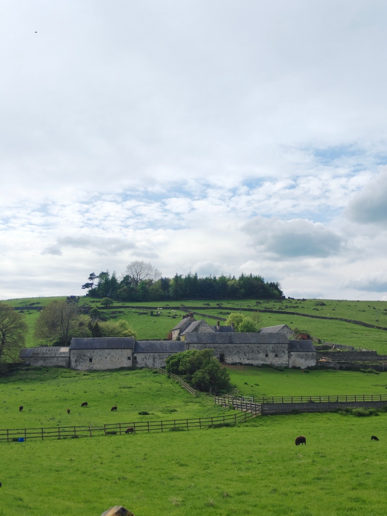
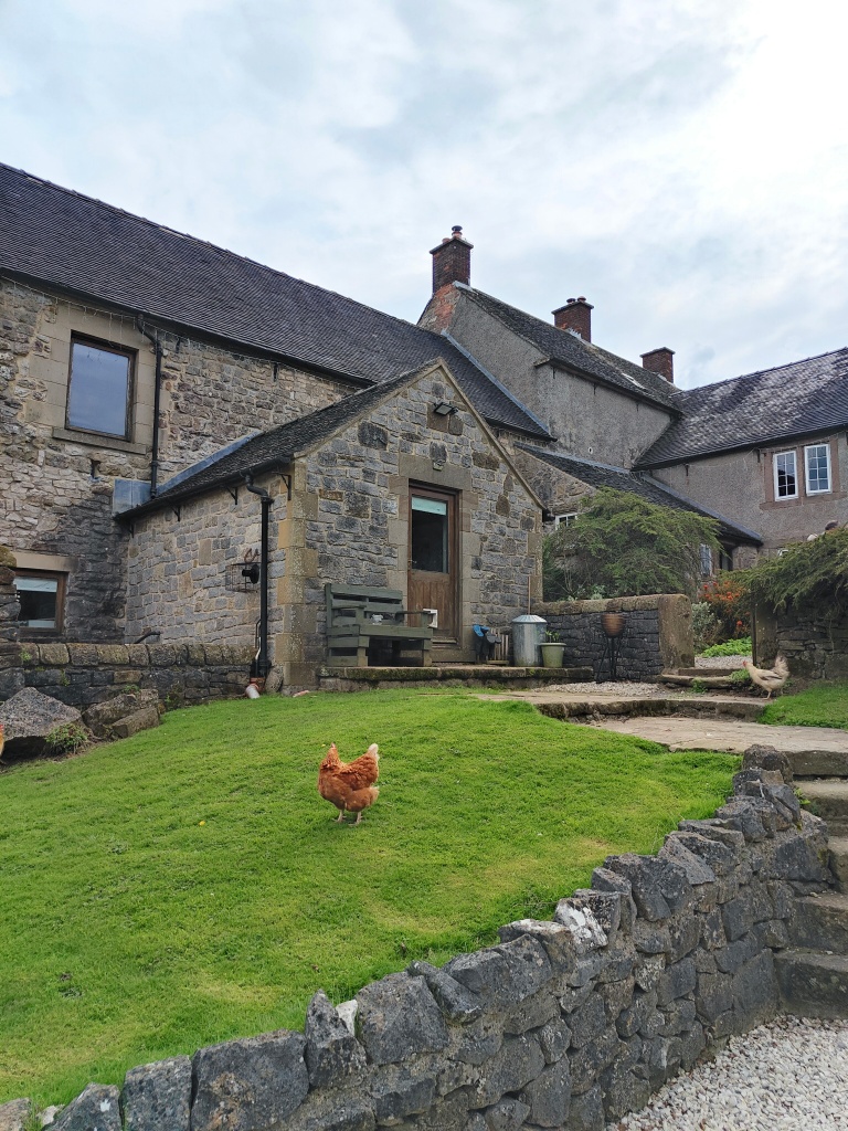
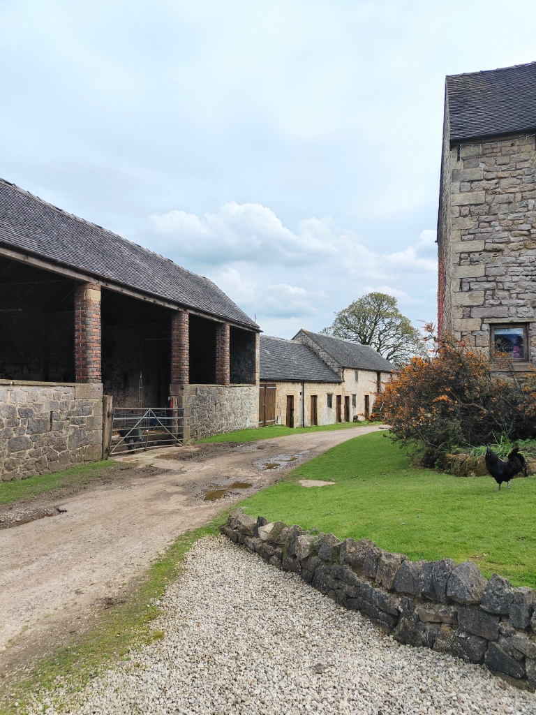
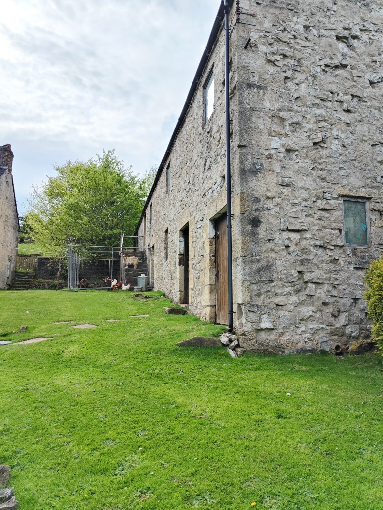
The walk then took us to the “modern” farm, which was constructed during the 18th century a few metres to the north, where current occupants Luke, Ruth and family hosted a very welcome refreshment break. The group was treated to homemade treats and cakes, tea, coffee and a glass or two of Pimms before taking a tour of the farmhouse outbuildings and stables, including an original stone cheese press, and being introduced to a selection of the current live stock, including a family of chickens, hens and roosters and the friendliest of goats.
On leaving the farm following the path to loop back to Minninglow, a Romano-British settlement (north) is a good example of a Romano-British period settlement complex of which only a few survive on the less cultivated ground of the limestone Peak District. This example is important because of the extensive survival of features relating to settlement of the period. The evidence for the survival of further unexcavated buildings means that the site will retain information about its construction and usage and much buried material is likely to survive.
These homesteads were being constructed and used by non-Roman natives throughout the period of the Roman occupation. Their origins lie in settlement forms developed before the arrival of the Romans. It is estimated 30-50 people lived here.
The site includes the remains of a building, interpreted as a farmhouse of the Romano-British period, together with outbuildings, terraces, and fragments of enclosure walls associated with the farmstead. The farmstead is located at the base of sloping ground in the dry limestone valley and may have been part of a small hamlet or village in the Roystone valley.
The farmhouse building is visible as a platform terrace, having a revetment wall on the downslope (eastern side) constructed from orthostats (upright boulders). Post holes found during an excavation in the 1980s provide evidence for the construction of the farmhouse. The position of these post holes is now marked by eight wooden posts. The building measured approximately 15m x 12m. A later phase of building was also discovered, which utilised limestone slabs and blocks in a construction. Associated with the settlement are fragments of orthostat walling to the north, west and east forming a small domestic enclosure around the building.
To the immediate south of the building is a terraced area, also partially excavated during the 1980s. This area revealed evidence for a wooden structure associated with the farmstead, together with artefacts, including pottery and coins, indicating a Romano-British date. This structure may have been a dwelling and measured about 15m by 6m, with a yard downslope. Further terracing and fragments of field walls in this area indicate that more extensive remains are likely to exist to the south and west of the excavated areas. These areas are likely to include the remains or one or more buildings. The construction of many walls in the immediate area, including those contained within the area of protection, contains constructional elements of the Romano-British period.
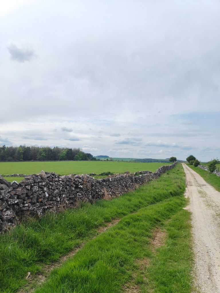
The circular walk heads back up to the starting point at the Minninglow car park on the High Peak Trail. The walk is around 3-4 miles, mostly along trail paths with a few fields and stiles along the way.
Source references:
Cromford and High Peak Railway – Wikipedia
Roman Roads in Derbyshire (twithr.co.uk)
Minninglow embankment, on the Cromford and High Peak Railway, 1959 (picturethepast.org.uk)
Cromford and High Peak Railway (go-plus.net)
Wall to wall history: The story of Roystone Grange by Richard Hodges. Duckworth 1991
Historic England Scheduled Monument Listings:
1009102 A chambered tomb and two bowl barrows on Minning Low
1018086 Romano-British settlement and field system immediately north west of Roystone Grange
1018088 Medieval grange and field system, 200m south of Royston Grange
1018089 Romano-British field system, 420m south east of Roystone Grange
Minning Low, Ballidon, Derbyshire | The Northern Antiquarian (wordpress.com)

Leave a comment